NexusLRS: Road Network Location Viewer
NexusLRS is an iPhone app that provides users with the ability to visualize their location on a road network (LRS) similar to how local municipalities, particularly state DOTs, view it. This utility falls under the Utilities & Tools category and offers various features to enhance the user experience.
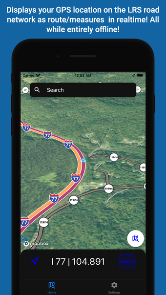
The app showcases your precise position on the LRS, including milepoint and routeid, with real-time updates every second. NexusLRS operates entirely offline post initial download, eliminating the need for network connectivity. Users are linked to a single municipality, enabling seamless offline mapping using locally stored base maps. Additionally, the app offers straight line diagrams of linear features along a route, catering to individuals and organizations frequently interacting with DOTs or DOT personnel.